Phipps Arch, Escalante, Utah
Description
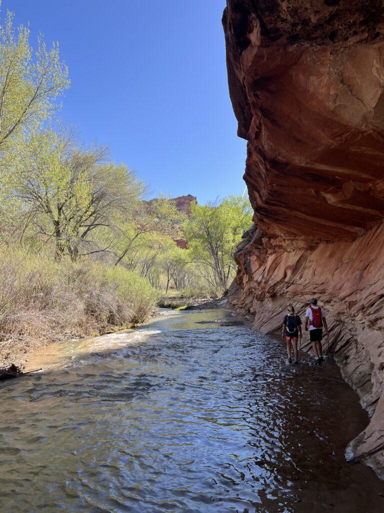
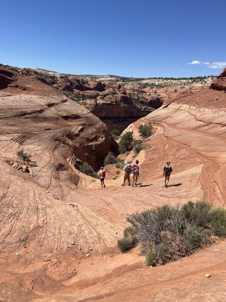
The hike to Phipps Arch requires commitment and a touch of patience with route finding. You will be rewarded for your efforts with a grand and mammoth arch. The trail begins by meandering along and through the Escalante River. This is one of our favorite parts, walking through the water felt refreshing and of course I enjoyed the opportunity to rock hound. Once you leave the river bed and start winding into the canyon, the entertainment is lessened until you start to climb.
Have caution while you climb. The trail up is not marked. It is an ‘every man for themselves’ situation, be aware that you must be able to come back down. Be aware of loose rocks, spot one another, and take your time. What worked best for us was to create a switchback-type pattern to gain elevation. The entire elevation gain is basically going from the canyon floor up to the arch itself.
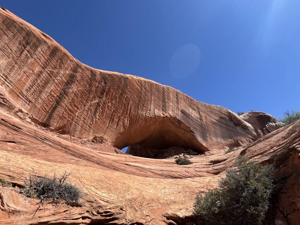
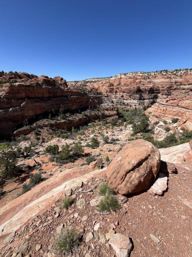
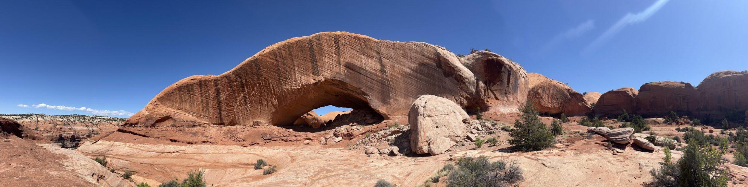
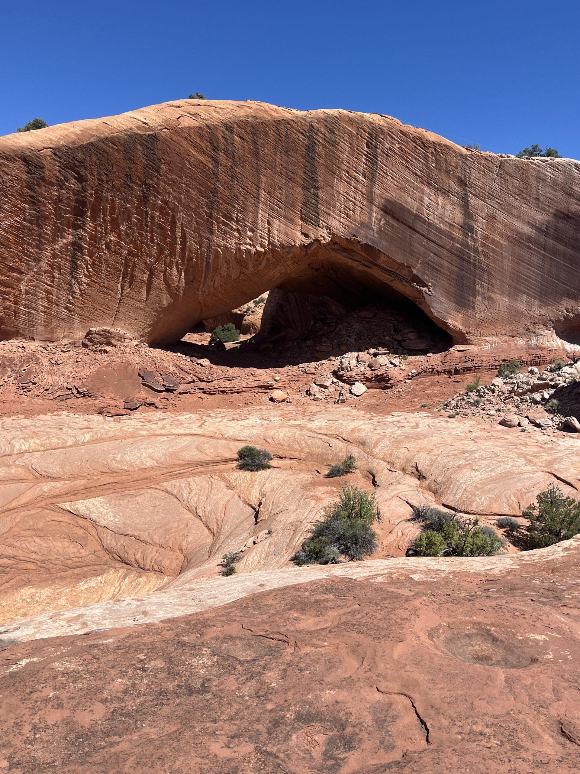
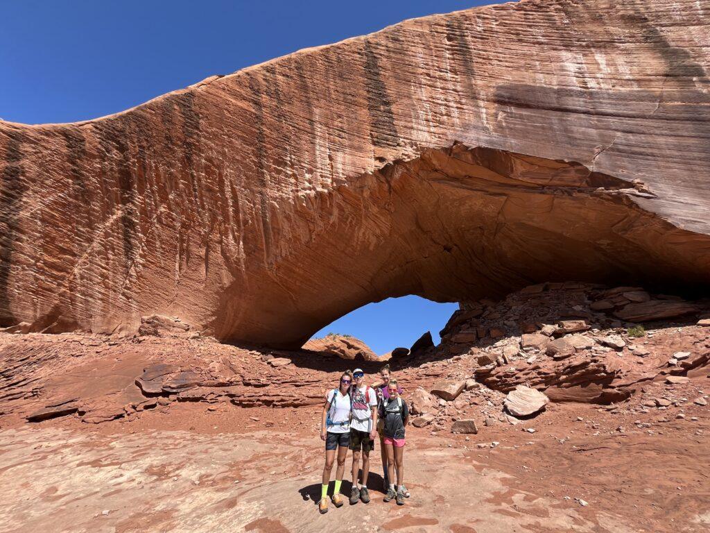
You will climb and climb, then suddenly you see the arch in all of its glory. This is a huge arch. There are some great boulders underneath it, providing a cool and comfortable place to have a rest, a snack, or picnic. The area around the arch is fun to walk around and explore for the views and different vantage points of the arch and canyon below. Take a moment to appreciate where you came from as you gaze down at the canyon floor below. Also, watch for the unofficial trail register under the arch. It’s really cool to see where fellow hikers are from that made it to Phipps Arch.
Tell Me More
Difficulty: Moderate to strenuous related to distance, exposure, short sections of steep scrambling and climbing.
Trail Stats: 6.4 miles, out and back, 603 feet elevation gain.
Trail Finding: Difficult. Initially, the trail is well marked and well traveled. However, once you leave the river bed and canyon floor area, there really is no set trail and route finding is difficult. As mentioned earlier, the arch is not visible until you are nearly right in front of it, so don’t expect to use the arch as your marker.
Conditions: Pretty much everything you could throw into the mix. Packed dirt, river walking, loose rock, short bouts of scrambling and climbing.
Would I Repeat This: Probably not, but we are glad we can say we did it and saw the arch.
Let’s Do This
Parking: There is parking available at the Escalante River Trailhead, as well as parking along the highway just adjacent to the trailhead.
Timing: Recommend earlier in the day related to only intermittent shade, as well as no shade at the time of your climb up to the arch.
Downloaded Map: Absolutely. The trail is poorly marked at junctions and also not marked at all when it’s time to climb.
Fees: None. You must register at the marked trailheads if you are camping in Grand Staircase Escalante National Monument.
Nearby Fun
Trails: Upper and Lower Calf Creek Falls, Escalante Natural Bridge, Peekaboo and Spooky Slot Canyon Loop, Devil’s Garden, 20 Mile Wash Dinosaur Trackway, and so much more. Escalante has a plethora of outdoor adventure options.
More Photos